It would be a stupidity to say that this road has not been walked before. In fact, many did it long time ago. In this post I will try to summarize those who have inspired me to choose this particular route. As we move through the text, the zoom will shift from the bottom of the walkscape (streets and corners) to its top (landscapes and territories). I am sure that I will forget some, but likewise I will find others as the project progresses.
It is impossible to start a work related to liveable neighorhoods without mentioning the masters piece of Jane Jacobs, The Death and Life of Great American Cities [1]. Neither an architect, nor a planner, this amazing woman with her Greenwich Village's neighbors won the battle against Robert Moses' plan to bulldoze a network of expressways and bridges through dozens of other neighborhoods. In her book Jacobs discussed in detail what makes dense cities work, and how modern urban design practices undermine many of the qualities that promote pedestrian use of the street and neighborhood contacts. Others works in this vein include Jan Gehl's Life between Buildings [2], and William H. Whyte's documentary film The Social Life of Small Urban Spaces [3].
 Jane Jacobs, center, at the White Horse Tavern, a mainstay of her block, in 1961, shortly after the publication of her epochal book (source: New York Times). // Jane Jacobs, en el centro, en la White Horse Tavern, un lugar de encuentro en su vecindario, en 1961, poco después de su gran libro (fuente: New York Times).
The next of the journey concerns to what is called landscape urbanism, and more concretely, the relatively recent formulations of professionals such as Rem Koolhaas, James Corner, Bernard Tschumi or Stan Allen. They claim for moving from both modernist and New Urbanist models of ordening the city, to more open-ended, strategic models. For them, horizontal surfaces (from the sidewalk to the entire matrix of urban surfaces) are understood as urban infrastrure and hence, urbanism should be a strategy towards the "irrigation of territories with potential" [4]. Unlike architecture, which consumes the potential of a site in order to project, urban infrastructure sows the seeds of future possibility, staging the ground for both uncertainty and promise [5].
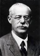
Finally, it is necessary to cite Ian L. McHarg's Design with nature [6]. From the streetscape to landscape urbanism to landscape ecology, McHarg's book brought together environmental and urban planning concerns. He proposed a methodology wherein landscapes could be analyzed according to their social values, and hence, as mentioned above, using the potential deficits to "design with nature". Indeed, this method was the precursor of the Environmental Impact Assessment (EIA) methodology as well as the Geographical Information Systems (GIS) applications. This vision is shared as well by other authors such as Fernando González Bernáldez and his Ecología y Paisaje [7], and James Lovelock, whose Gaia hypothesis warns us about the complex ties which connected the physical and biological components of Earth's landscapes [8]
Leer en castellano...

The next of the journey concerns to what is called landscape urbanism, and more concretely, the relatively recent formulations of professionals such as Rem Koolhaas, James Corner, Bernard Tschumi or Stan Allen. They claim for moving from both modernist and New Urbanist models of ordening the city, to more open-ended, strategic models. For them, horizontal surfaces (from the sidewalk to the entire matrix of urban surfaces) are understood as urban infrastrure and hence, urbanism should be a strategy towards the "irrigation of territories with potential" [4]. Unlike architecture, which consumes the potential of a site in order to project, urban infrastructure sows the seeds of future possibility, staging the ground for both uncertainty and promise [5].
Finally, it is necessary to cite Ian L. McHarg's Design with nature [6]. From the streetscape to landscape urbanism to landscape ecology, McHarg's book brought together environmental and urban planning concerns. He proposed a methodology wherein landscapes could be analyzed according to their social values, and hence, as mentioned above, using the potential deficits to "design with nature". Indeed, this method was the precursor of the Environmental Impact Assessment (EIA) methodology as well as the Geographical Information Systems (GIS) applications. This vision is shared as well by other authors such as Fernando González Bernáldez and his Ecología y Paisaje [7], and James Lovelock, whose Gaia hypothesis warns us about the complex ties which connected the physical and biological components of Earth's landscapes [8]
Leer en castellano...


